Bare-earth terrain mapping
Classify ground returns separately from vegetation and structures to build a digital terrain model. Use the resulting surface and contours to review slopes, drainage paths, and access routes or plan grading before construction. Ground coverage depends on how many laser returns reach the ground. USGS explanation of LiDAR and bare-earth models.
Transmission rights-of-way
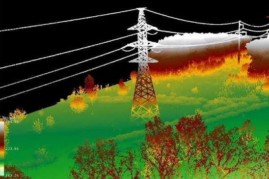
Capture towers, conductors, surrounding vegetation, and terrain along the corridor. Use the point cloud and corridor profiles to screen for potential vegetation encroachment, identify spans for follow-up clearance review, and plan crew access. Confirm corridor width, point density, and accuracy needs before capture. IEEE research on LiDAR for power-line vegetation management.